Сурет:Scottish Borders map.png

Бұл алдын ала көрудің өлшемі: 596 × 599 пиксел. Басқа ажыратылымдықтар: 239 × 240 пиксел | 477 × 480 пиксел | 900 × 905 пиксел.
Түпнұсқа файл (900 × 905 пиксел, файл өлшемі: 88 КБ, MIME түрі: image/png)
| Бұл файл Wikimedia Commons? жобасынан, сондықтан басқа жобаларда да қолдануы мүмкін. Commons ашық лицензиялы медиа файл қоры. Сіз жобаға көмектесе аласыз. |
Ортаққордан қарау |

|
This file was moved to Wikimedia Commons from wts.oldwikivoyage using a bot script. All source information is still present. It requires review. Additionally, there may be errors in any or all of the information fields; information on this file should not be considered reliable and the file should not be used until it has been reviewed and any needed corrections have been made. Once the review has been completed, this template should be removed. For details about this file, see below. Check now! |
Түйін
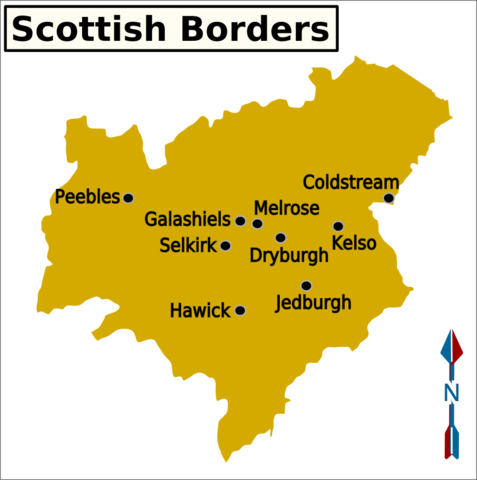
| Сипаттамасы | Wikivoyage-style map of the Scottish Borders region showing the major cities. |
| Күні | 19 қараша 2006 (original upload date) |
| Көзі | Image:UK map.svg (this image is a PNG export from a small subset of the UK map SVG) |
| Авторы | Original image by User: (WT-shared) Paul. at wts wikivoyage, derivative work by Shaundd |
| Location | Шотландия |
Лицензиялау
Бұл файл Creative Commons Attribution-Share Alike 1.0 Generic лицензиясы бойынша қолжетімді
- Сіз келесі әрекеттерге еркінсіз:
- бөлісу – туындыны көшіру, тарату және тапсыру
- мазмұнын өзгерту – туындыны бейімдеу
- Келесі ережелерді сақтағанда:
- атрибуция – Авторлықты белгілеп, лицензияға сілтеме беріп, өзгеріс жасалғанын анықтауыңыз керек. Сіз мұны кез келген орынды жолмен істей аласыз, бірақ лицензиар сізді немесе қолдануыңызды мақұлдайтындай емес.
- бірдей шарттарда тарату – If you alter, transform, or build upon this work, you must distribute the resulting work under the same license as the original.
Тұпнұсқа жүктеу журналы
| This file was imported from Wikivoyage WTS. |
The original description page was here. All following user names refer to wts.wikivoyage-old.
- 2006-11-19 23:26 (WT-shared) Paul.[dead link] 1190×1164 (29561 bytes) Map of the Scottish Borders showing regions and major cities Source: [[:Image:UK map.svg]] (Import from wikitravel.org/shared)
Файл тарихы
Файл сол кезде қалай көрінгенін көру үшін күн/уақыт дегенге басыңыз.
| Күн/Уақыт | Нобай | Өлшемдер | Қатысушы | Пікір | |
|---|---|---|---|---|---|
| қазіргі | 10:59, 2015 ж. қаңтардың 3 | | 900 × 905 (88 КБ) | Shaundd | increase font size, add map name and arrow |
| 07:35, 2012 ж. қарашаның 18 |  | 1190 × 1164 (29 КБ) | MGA73bot2 | {{BotMoveToCommons|wts.oldwikivoyage|year={{subst:CURRENTYEAR}}|month={{subst:CURRENTMONTHNAME}}|day={{subst:CURRENTDAY}}}} == {{int:filedesc}} == {{Information |description=Map of the Scottish Borders showing regions and major cities {{map|Scotland}}... |
Файл қолданылуы
Бұл файлды мына бет қолданады:
Глобалды файл қолданылуы
Бұл файл келесі басқа уикилерде қолданылады:
- ce.wikipedia.org жобасында қолданылуы
- de.wikivoyage.org жобасында қолданылуы
- en.wikivoyage.org жобасында қолданылуы
- it.wikivoyage.org жобасында қолданылуы
- kbd.wikipedia.org жобасында қолданылуы