Сурет:Second ETR in China.svg

Size of this PNG preview of this SVG file: 705 × 599 пиксел. Басқа ажыратылымдықтар: 282 × 240 пиксел | 565 × 480 пиксел | 904 × 768 пиксел | 1205 × 1024 пиксел | 2409 × 2048 пиксел | 1000 × 850 пиксел.
Түпнұсқа файл (SVG файлы, кесімді 1000 × 850 (пиксел) нүкте, файл өлшемі: 233 КБ)
| Бұл файл Wikimedia Commons? жобасынан, сондықтан басқа жобаларда да қолдануы мүмкін. Commons ашық лицензиялы медиа файл қоры. Сіз жобаға көмектесе аласыз. |
Ортаққордан қарау |
Түйін
| Сипаттамасы |
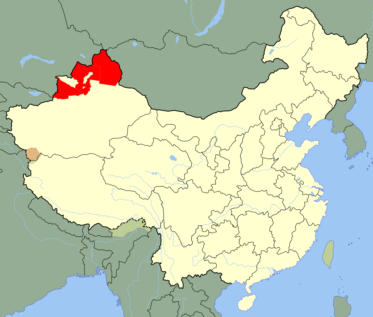
A SVG map of the modern-day districts in which the Second East Turkestan Republic was located; highlighted in red . Legend: |
||
| Күні | (UTC) | ||
| Көзі | |||
| Авторы |
|
||
| SVG genesis | Бұл векторлық сурет Inkscape көмегімен жасалған.
|
Лицензиялау
Мен бұл туындының авторымын, келесі лицензия аясында бұны жариялаймын:
| I, the copyright holder of this work, release this work into the public domain. This applies worldwide. In some countries this may not be legally possible; if so: I grant anyone the right to use this work for any purpose, without any conditions, unless such conditions are required by law. |
Тұпнұсқа жүктеу журналы
This image is a derivative work of the following images:
- File:China Xinjiang Ili.svg licensed with PD-self
- 2010-02-12T14:50:12Z Joowwww 1000x850 (238668 Bytes) {{Information |Description=An SVG map of China with Xinjiang highlighted in orange and Ili Prefecture highlighted in red Legend:[[:File:China map legend.png]] |Source=self-made; based on CIA public domain maps: *http://www.l
Uploaded with derivativeFX
Файл тарихы
Файл сол кезде қалай көрінгенін көру үшін күн/уақыт дегенге басыңыз.
| Күн/Уақыт | Нобай | Өлшемдер | Қатысушы | Пікір | |
|---|---|---|---|---|---|
| қазіргі | 02:59, 2020 ж. мамырдың 25 | | 1000 × 850 (233 КБ) | Roy17 | Reverted to version as of 02:12, 12 July 2010 (UTC) |
| 08:49, 2020 ж. мамырдың 24 |  | 1000 × 850 (271 КБ) | Anchuhu | Reverted to version as of 13:12, 19 January 2019 (UTC) USSR still in 1946 and Second ETR controlled larger than ill,include Qaramay | |
| 07:40, 2020 ж. наурыздың 12 |  | 1000 × 850 (233 КБ) | Jonteemil | Fake SVG Reverted to version as of 02:12, 12 July 2010 (UTC) | |
| 19:12, 2019 ж. қаңтардың 19 |  | 1000 × 850 (271 КБ) | 复旦大学张超 | edit | |
| 08:12, 2010 ж. шілденің 12 |  | 1000 × 850 (233 КБ) | Splittist | {{Information |Description=An SVG map of China with Xinjiang's Ili, Tarbaghatai, and Altai districts highlighted in red. These are the districts claimed by the Second East Turkestan Republic. Legend:<br />[[File:Ch |
Файл қолданылуы
Бұл файлды мына бет қолданады:
Глобалды файл қолданылуы
Бұл файл келесі басқа уикилерде қолданылады:
- ar.wikipedia.org жобасында қолданылуы
- az.wikipedia.org жобасында қолданылуы
- bn.wikipedia.org жобасында қолданылуы
- de.wikipedia.org жобасында қолданылуы
- en.wikipedia.org жобасында қолданылуы
- et.wikipedia.org жобасында қолданылуы
- fr.wikipedia.org жобасында қолданылуы
- id.wikipedia.org жобасында қолданылуы
- it.wikipedia.org жобасында қолданылуы
- ja.wikipedia.org жобасында қолданылуы
- jv.wikipedia.org жобасында қолданылуы
- mk.wikipedia.org жобасында қолданылуы
- ms.wikipedia.org жобасында қолданылуы
- nl.wikipedia.org жобасында қолданылуы
- pnb.wikipedia.org жобасында қолданылуы
- pt.wikipedia.org жобасында қолданылуы
- ru.wikipedia.org жобасында қолданылуы
- sl.wikipedia.org жобасында қолданылуы
- sv.wikipedia.org жобасында қолданылуы
- th.wikipedia.org жобасында қолданылуы
- tr.wikipedia.org жобасында қолданылуы
- ug.wikipedia.org жобасында қолданылуы
- uk.wikipedia.org жобасында қолданылуы
- ur.wikipedia.org жобасында қолданылуы
- uz.wikipedia.org жобасында қолданылуы
- vi.wikipedia.org жобасында қолданылуы
- www.wikidata.org жобасында қолданылуы
- zh.wikipedia.org жобасында қолданылуы