Сурет:Typhoon Mawar 2005 computer simulation thumbnail.gif

Typhoon_Mawar_2005_computer_simulation_thumbnail.gif(450 × 403 пиксел, файл өлшемі: 869 КБ, MIME түрі: image/gif, тұйық, 49 кадр, 5,3с)

Бұл файл Wikimedia Commons? жобасынан, сондықтан басқа жобаларда да қолдануы мүмкін.

Commons ашық лицензиялы медиа файл қоры. Сіз жобаға көмектесе аласыз.

Ортаққордан қарау Ортаққордан қарау
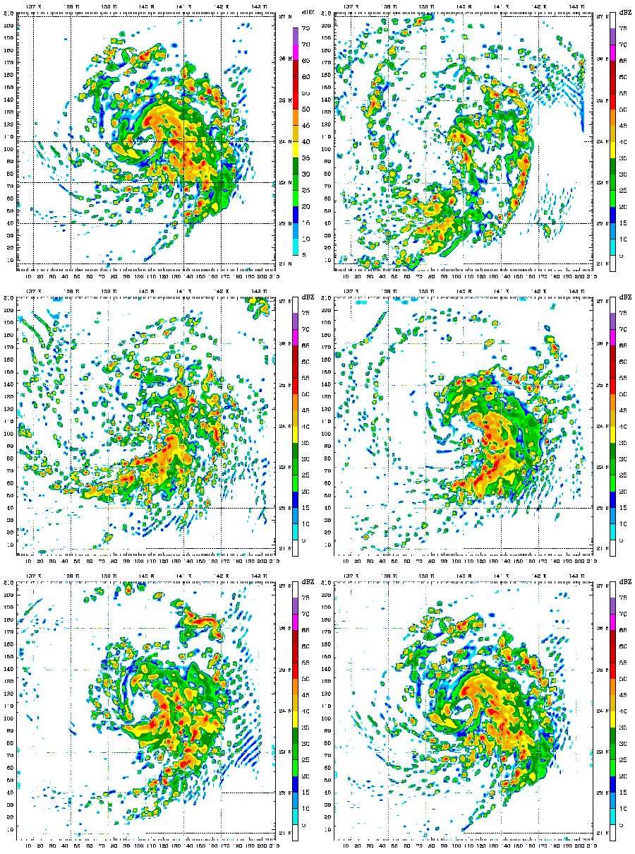
Сипаттамасы A 48 hour simulation of Typhoon Mawar using the Weather Research and Forecasting model. At this time, Mawar was at approximately 24N 140E and moving slowly to the north. Initial conditions and boundary conditions are from the 1 degree FNL reanalysis (approximately 110 kilometers, 68 miles). The simulation runs from 22 August 2005 00:00 Zulu to 24 August 2005 00:00 Zulu. The model has 3.3 kilometre (2.1 mile) grid point spacing, and utilizes vortex following which is why the typhoon remains in the middle of the frame. Approximately the first 24 hours (frames) show the model "spinning up"— which is the amount of time needed for the model physics to reach equilibrium with the applied boundary conditions. After the initial round of convection in the first couple frames, gravity waves can be seen propagating outward from the center of convection, especially in the northwest quadrant of the storm system. The final 24 hours (frames) represent a high resolution simulation of the actual typhoon. The reds and oranges represent high rainfall rates, blues and greens light rainfall, and the white are regions of no rainfall.
Күні (UTC)
Көзі
Авторы


This is a retouched picture, which means that it has been digitally altered from its original version. Modifications: create thumbnail. The original can be viewed here: Typhoon Mawar 2005 computer simulation.gif. Modifications made by Atmoz.

Мен бұл туындының авторымын, келесі лицензия аясында бұны жариялаймын:
w:en:Creative Commons
атрибуция бірдей шарттарда тарату
Бұл файл Creative Commons Attribution-Share Alike 3.0 Unported лицензиясы бойынша қолжетімді.
Сіз келесі әрекеттерге еркінсіз:
  • бөлісу – туындыны көшіру, тарату және тапсыру
  • мазмұнын өзгерту – туындыны бейімдеу
Келесі ережелерді сақтағанда:
  • атрибуция – Авторлықты белгілеп, лицензияға сілтеме беріп, өзгеріс жасалғанын анықтауыңыз керек. Сіз мұны кез келген орынды жолмен істей аласыз, бірақ лицензиар сізді немесе қолдануыңызды мақұлдайтындай емес.
  • бірдей шарттарда тарату – Материалды араластырсаңыз, түрлендірсеңіз немесе құрастырсаңыз, үлестеріңізді түпнұсқамен бірдей бірдей немесе үйлесімді лицензия бойынша таратуыңыз керек.

Тұпнұсқа жүктеу журналы

This image is a derivative work of the following images:

  • File:Typhoon_Mawar_2005_computer_simulation.gif licensed with Cc-by-sa-3.0
    • 2010-07-01T15:52:43Z Atmoz 1380x1235 (4622294 Bytes) fix transparency "issue"
    • 2010-07-01T15:48:49Z Atmoz 1380x1235 (4627300 Bytes) last frame first
    • 2010-07-01T05:59:02Z Atmoz 1380x1235 (4655873 Bytes) {{Information |Description=A 48 hour simulation of [[w:Typhoon Mawar|Typhoon Mawar]] using the [[w:Weather Research and Forecasting model|Weather Research and Forecasting model]]. Initial conditions and boundary conditions ar

Uploaded with derivativeFX

Captions

Add a one-line explanation of what this file represents

Items portrayed in this file

суреттелген нәрсе

copyright status ағылшын тілі

copyrighted ағылшын тілі

copyright license ағылшын тілі

inception ағылшын тілі

1 шілде, 2010

Файл тарихы

Файл сол кезде қалай көрінгенін көру үшін күн/уақыт дегенге басыңыз.

Күн/УақытНобайӨлшемдерҚатысушыПікір
қазіргі21:59, 2010 ж. шілденің 121:59, 2010 ж. шілденің 1 кезіндегі нұсқасының нобайы450 × 403 (869 КБ)Atmoz{{Information |Description=A 48 hour simulation of Typhoon Mawar using the Weather Research and Forecasting model. Initial conditions and boundary conditions are 1 degree reanalysis. |Source

Бұл файлды мына бет қолданады:

Глобалды файл қолданылуы

Бұл файл келесі басқа уикилерде қолданылады:

Метадеректер