Сурет:Latium et Campania.png
Түпнұсқа файл (1158 × 822 пиксел, файл өлшемі: 7,38 MB, MIME түрі: image/png)
| Бұл файл Wikimedia Commons? жобасынан, сондықтан басқа жобаларда да қолдануы мүмкін. Commons ашық лицензиялы медиа файл қоры. Сіз жобаға көмектесе аласыз. |
Ортаққордан қарау |
Түйін
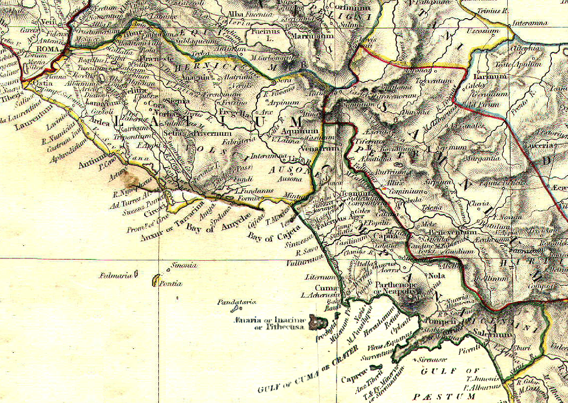
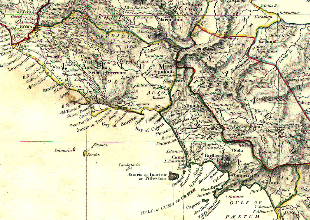
| Сипаттамасы | Reference map for Roman Empire Regium I Latium et Campania | ||||||||||||||||||||||
| Күні | |||||||||||||||||||||||
| Көзі | The Historical Atlas by William R. Shepherd, 1911 | ||||||||||||||||||||||
| Авторы |
|
||||||||||||||||||||||
| Рұқсат (Бұл файлды қайта қолдану) |
public domain because its copyright has expired | ||||||||||||||||||||||
Лицензиялау
|
Бұл туынды АҚШ-тың қоғамдық қазынасы және бұл елдерде авторлық құқық сақталу мерзімі авторы қайтыс болғанына 70 жылдан асқан немесе одан аз болады.
| |
| Бұл файл белгілі авторлық құқықтардан, сондай-ақ байланысқан және сабақтас құқықтардан еркін болып анықталған | |
Файл тарихы
Файл сол кезде қалай көрінгенін көру үшін күн/уақыт дегенге басыңыз.
| Күн/Уақыт | Нобай | Өлшемдер | Қатысушы | Пікір | |
|---|---|---|---|---|---|
| қазіргі | 17:06, 2008 ж. мамырдың 1 | | 1158 × 822 (7,38 MB) | GlióPanteco | {{Information |Description=Reference map for Roman Empire Regium I Latium et Campania |Source=''The Historical Atlas'' by William R. Shepherd, 1911 |Date=May 1st 2008 |Author=William R. Shepherd |Permission=public domain because its copyright has expired |
Файл қолданылуы
Бұл файлды мына бет қолданады:
Глобалды файл қолданылуы
Бұл файл келесі басқа уикилерде қолданылады:
- ar.wikipedia.org жобасында қолданылуы
- bg.wikipedia.org жобасында қолданылуы
- da.wikipedia.org жобасында қолданылуы
- en.wikipedia.org жобасында қолданылуы
- es.wikipedia.org жобасында қолданылуы
- et.wikipedia.org жобасында қолданылуы
- fi.wikipedia.org жобасында қолданылуы
- fr.wikipedia.org жобасында қолданылуы
- id.wikipedia.org жобасында қолданылуы
- it.wikipedia.org жобасында қолданылуы
- Napoli
- Sperlonga
- Calvi Risorta
- Alatri
- Anagni
- Aquino
- Arpino
- Atina
- Trevi nel Lazio
- Cori
- Priverno
- Sezze
- Castel Volturno
- Cales
- Ariccia
- Lanuvio
- Palestrina
- Velletri
- Cuma
- Atella (città antica)
- Capua (città antica)
- Roma (città antica)
- Gaeta
- Forum Appii
- Bovillae
- Oplontis
- Giugliano in Campania
- Terracina
- Nuceria Alfaterna
- Stabia
- Avella
- Vescia (città)
- Pentapoli aurunca
- Lavinio (città antica)
- Ceccano
- Crustumerium
- Miseno (Bacoli)
Бұл файлдың глобалды қолданылуын көбірек көру.